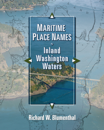
MARITIME PLACE NAMES Inland Washington Waters

MARITIME PLACE NAMES Inland Washington WatersMARITIME PLACE NAMES Inland Washington Waters is a historical text on Washington state maritime place names. It includes every named island, bay, point, inlet, pass, harbor, channel, strait, canal, passage, peninsula, rock, head, bank, bight, cove, lagoon, spit, sound, canal and shoal identified on current nautical charts. Variants and more obscure local names are frequently included as well as historical names that did not stand the test of time.

The book generally identifies the individual who named the place, when, why and for whom. In many cases, it also identifies the chart where the name first appeared.

Heavily annotated, the manuscript makes extensive use of quotes of the observations from our earliest explorers, to document their reasons for various names and to provide readers with an impression of what Puget Sound country looked like 150-200 years ago. The book includes a thorough discussion of each of these explorations as it relates to individual place names.

Where available, the text includes the early settlement history of each location. Who arrived first, what did they do, did they log, farm or fish, what hardships did they face, what about their families? The book includes a great deal of information on Indian lore, so important to our early history and place names.

The book contains about 100 aerial photographs of various places throughout our inland waters, as well as 30 historical charts beginning with the early voyages of the Spanish and continuing with those George Vancouver, Charles Wilkes, Admiralty Captains Henry Kellett and George Richardson, and James Alden from the U.S. Coast Survey. These charts range from the 1780s to the late 1800s and are fascinating to view from the standpoint of their accuracy. The precision is amazing when you realize the only instruments they used were a sextant and a log line. The book also contains 40 original panoramic landscape sketches. George Davidson began drawing these as early as 1851. The number of views grew through the years with the assistance of other explorers and artists to provide the reader with a broader image of our shoreline features.

A welcome companion while boating in our waters, useful for research purposes, or simply a good read for general entertainment, there is no equivalent scholarly text which provides more information on our early maritime history.

Read an excerpt -or- Look Inside

$29.95

WA residents 10% sales tax added at final checkout


4 Reviews for MARITIME PLACE NAMES Inland Washington Waters

  1. Yvonne says:

    This is a wonderful book for anyone who wants to explore and learn more about Inland Washington Waters. The origins of the place names are fasinating, and the photos and charts are a great resource.

  2. To a sailor, names for places that touch the water are always fascinating. They tell more of a story than just naming something for someone. For example, the place names that imply disaster or disappointment reflect the thinking of the explorers who named them. And the names of places for people reflect either the thanks for favors and funding, hopefulness for funding to come, or to honor a shipmate. So Mr. Blumenthal’s work, fitting in with recent historical atlases of the same areas, adds to the scholarship of the times. As both a professional mariner, and the head of the volunteer group that helps care for one of the places named in this book, I started with my own point, Point Robinson. But then I was sucked into turning page after page, and you will probably do so, too.
    This is a subject that always attracts the historical purists. The finding of an error is gleefully reported to the author. As Mr. Blumenthal has already reported to me that he has found a few just for starters, I will not join in on that exercise. I will only say thank you for doing the hard work that goes into a work like this, use it a reference for my tours of our lighthouse, and enjoy the descriptions and the narrative.
    Captain Joe

  3. As a land conservation professional in the San Juan Islands, I lean heavily on publications like this to help my organization (the San Juan Preservation Trust) understand the human history of the properties we protect. We’ve assembled a large library of local history resources, yet we continue to have a hard time finding background information on some of the more obscure places where we do our work. Mr. Blumenthal’s book is more comprehensive and accessible than anything else I’ve seen, and from here forward will serve as our first reference source.

  4. Alan Parsons says:

    Comprehensive and extensively researched (check out the bibliography!), this is a useful reference for history buffs or anyone involved in outdoor activities on and around Puget Sound and the San Juan Islands.

    By including every named island, bay, point, inlet, pass, harbor, channel, strait, canal, passage, peninsula, rock, head, bank, bight, cove, lagoon, spit, sound, canal and shoal identified on current nautical charts, this book fills a void of information that I was not able to find elsewhere in one source.

    The book also contains over 100 aerial photographs, 40 historical landscape sketches of shoreline features (dating from 1851), and charts from the British, Spanish, and American explorations dating from 1790.

Leave a Reply

Your email address will not be published. Required fields are marked *